Jim in Palau
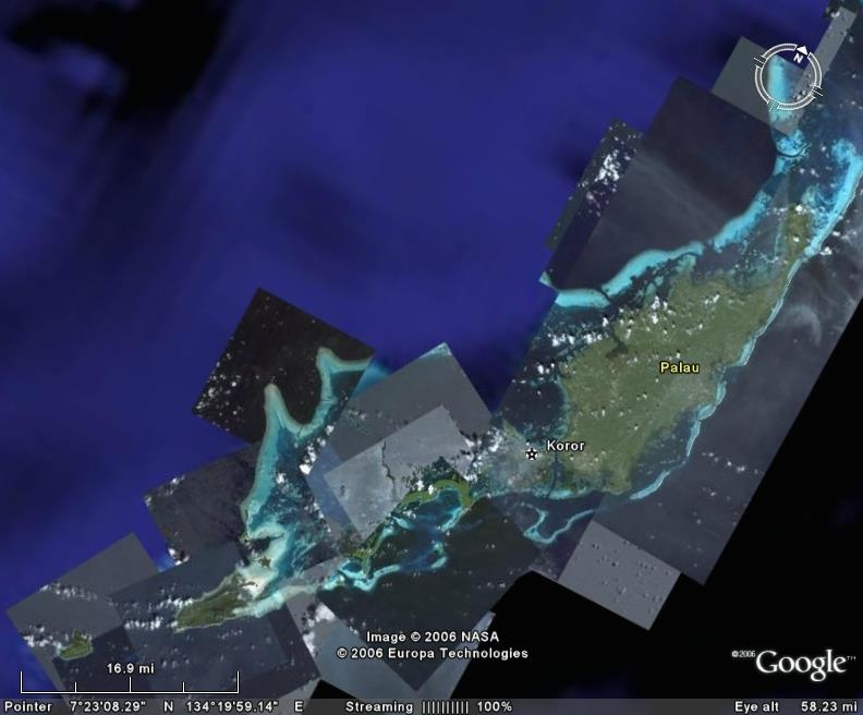
Palau tilted away from North to maximize the picture
Below is the picture above broken into important segments, roughly as they would be above from the southern end of Babeldaob and northern Koror islands in the first pic below to Angaur Island as the last and farthest south of the main body of Palauan Islands. Peleliu and Angaur Islands were the target of major US landings in World War II. These landings did not go as the 'turkey shoot' naval battle on the 30 and 31 of march in 1944. The battle was forecast to take only several days with minimal losses. It took several months and we sustained the greatest losses the United States has ever taken in battle. The Japanese withstood intense shelling buy our Battleships and Destroyers by living in caves and tunnels until our troops hit the beaches. Naval commanders cancelled the third day of pre invasion shelling as they thought every living thing on the islands had been killed.
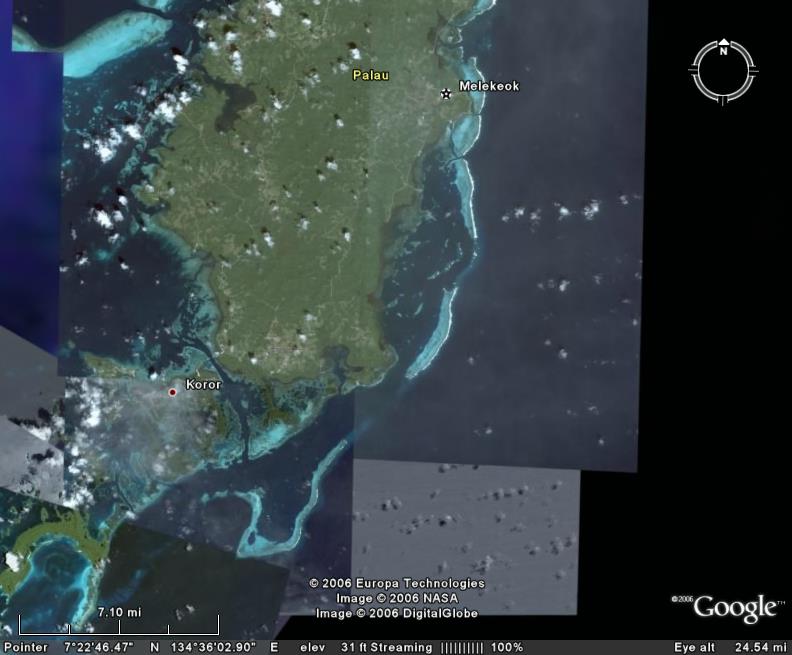 |
Southern Babeldaob to Northern Koror |
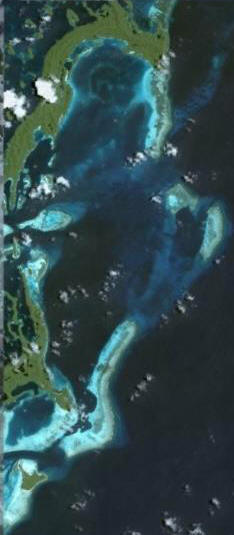  |
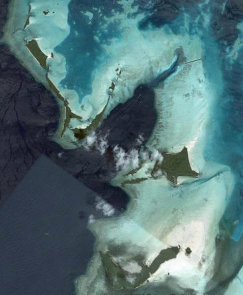
Siaes Complex on the left and Urukthapel Island on the right. Saies Corner is the top point of the U shaped reef. Coming down slightly on the inside of the U is Saies Cave and a little over half way down is Ulong Channel. The bottom left side of the reef is almost to Blue Corner. In the same picture on the left but on it's right side is Ulong Island (where survivor was filmed) and the gap to it's right before the tip of another is named Big Toi. |
 |
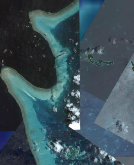
Blue Corner Complex almost down to Peleliu Island. In the upper right corner you can see the manmade German Channel, as a straight cut through the reef. This is the passage at low and medium tides to get outside the reef. |
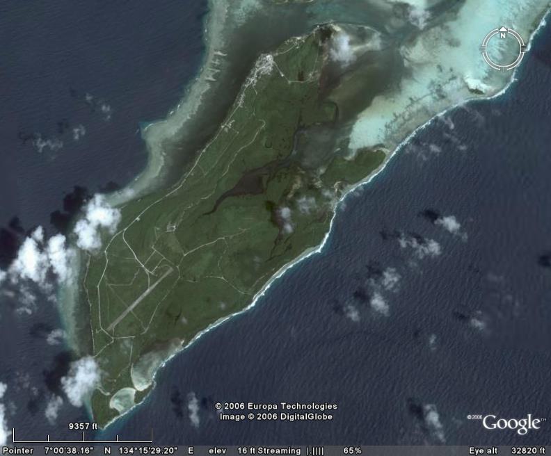 |
Peleliu Island The airstrip is clearly visible on the southern side of the island. In World War 2 there was a runway bisecting and at 90º to this runway. Two ends of the runway had a large connecting taxi-way that formed the number 4 from the air. The United States Air Force C.A.T. team is currently installing aircraft landing lights so the strip will be more inviting to larger aircraft. The runway is in poor repair and crosses the north latitude of perfectly 7 Degrees north of the equator. |
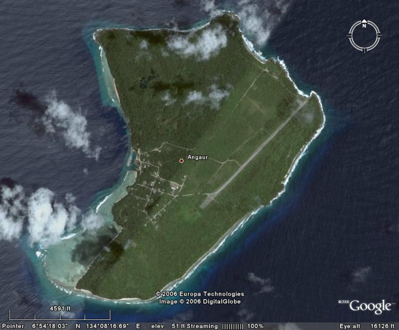 |
Anguar Island The farthest island to the south of the main body of Palau. The airstrip is clearly visible on the eastern side of the island. |
Dive sites below
Click on picture to enlarge
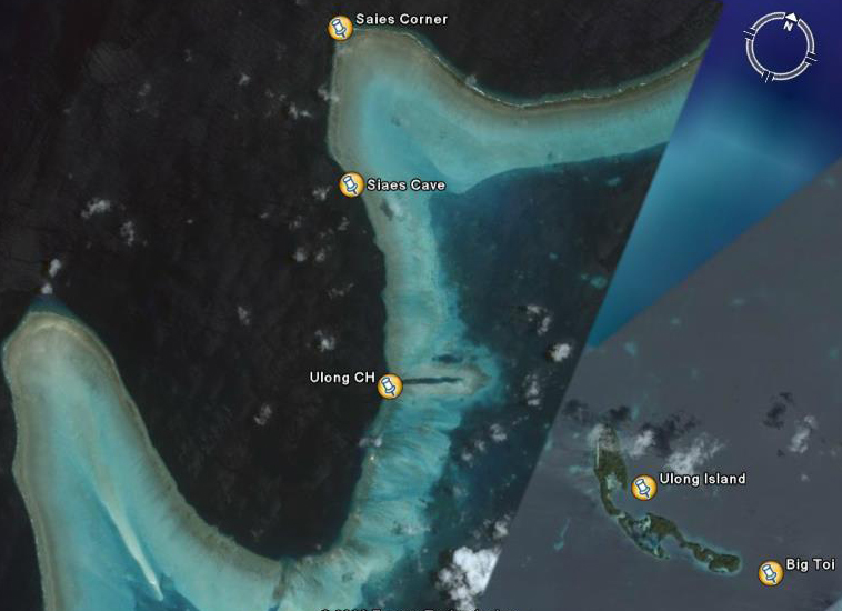
Picture #1 above is the Saies Complex with Saies Corner, Saies Cave or Tunnel and Ulong Channel.
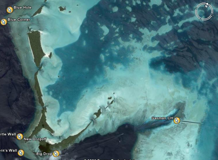
Picture #2 above is the Blue Corner Complex with Blue Corner, Blue Holes Ferns Wall
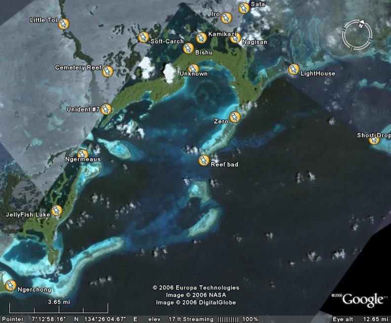
Picture #3 has many of the dive sites including the WW-II shipwrecks Sata, Iro Nagisan, Kamakazi, Bishu, Unidentified #7 (from Dan bailey's Book) all Maru ships. There is a Fighter aircraft (Zero) to the right on a bad reef, Soft Coral Arch and Ngerchong, Ngermeaus Islands. Most are around Urukthapel Island. Short Droppoff, JellyFish Lake and Cemetery Reef are shown. Little Toi is the break in the islands where most of the dive boats go to get outside the reef.
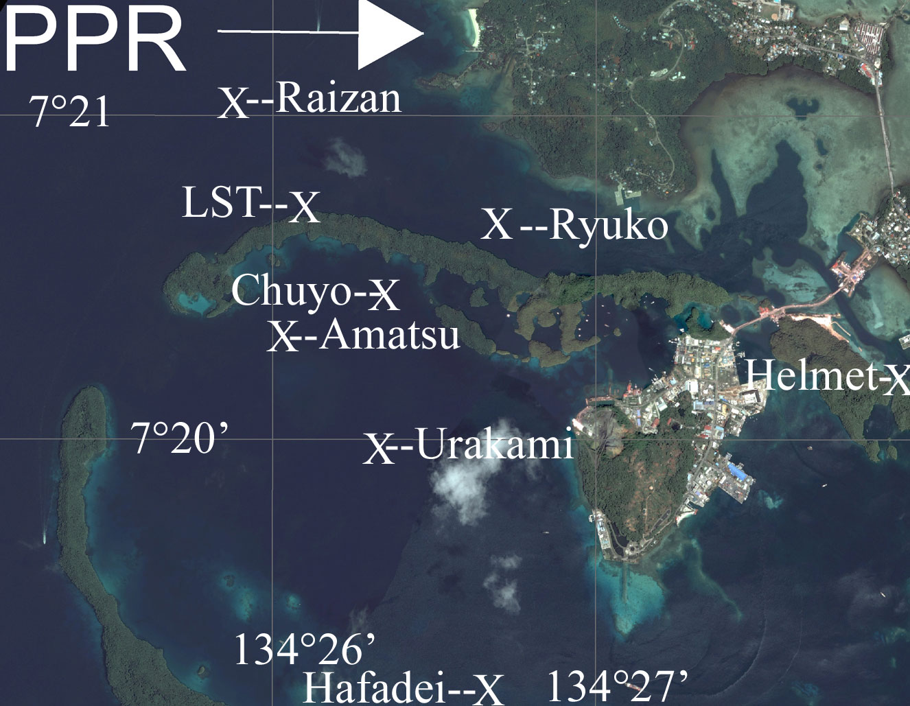
Picture #4 Has the Hafadeiat the bottom, PPR at the top and the Helmet Shipwreck to the right. There are two long islands running to the left forming a top and bottom of the protected harbor. The Ryuko, and LST are on one side (North) and Amatsu and Choyo are on the other (South) of Nagarcol Island. The Urakami is in mid harbor. The Amatsu, Chuyo, Urakami and Ryuko are WW-II shipwrecks. PPR's pure white beach can be seen running vertically at the top of the picture.
For a larger picture click on Picture to enlarge